- 1. Trabocchi Greenway, the cycling path along the Abruzzo coast
- 2. Trabocchi Greenway, the cycling path along the Abruzzo coast
- 3. Francavilla - Ortona
- 4. Ortona - San Vito
- 5. San Vito - Fossacesia
- 6. Fossacesia - Torino di Sangro
- 7. Torino di Sangro - Punta Aderci
- 8. Punta Aderci - Vasto Marina
- 9. Map and Chart
Trabocchi Greenway, the cycling path along the Abruzzo coast

The Trabocchi Greenway is a cycling route that traverses one of the most picturesque and famous stretches of the Adriatic coast. The Trabocchi coast is that section of the Abruzzo sea - and especially the province of Chieti - where it is still possible today to find remnants of ancient fishing machines (the trabocchi, precisely).
The cycling path called "Greenway", which follows what was once the railway route of the Adriatic coast, abandoned in 2005, aims to connect as many as 8 different municipalities.
It is a scenic trail that offers a new and absolutely enchanting viewpoint of beaches, rocks and coves, protected natural areas, and small villages to discover.
Today it has not yet been fully completed, but much of the route is currently passable. Here are the stages of the Trabocchi Greenway.
Trabocchi Greenway, the cycling path along the Abruzzo coast

- Francavilla - Ortona
- Ortona - San Vito
- San Vito - Fossacesia
- Fossacesia - Torino di Sangro
- Torino di Sangro - Punta Aderci
- Punta Aderci - Vasto Marina
Francavilla - Ortona
The first part of the cycling path has not yet been completed and therefore, in some sections, it is necessary to use state or internal roads to complete the route.
This first stage allows you to reach the beach at Ritorna and the lighthouse and castle of Ortona, cycling at the foot of the hill of Ripari di Giobbe (accessible only on foot otherwise).
Ortona - San Vito
This stretch passes through three different tunnels that were previously designated for the railway and closely follows the Saraceni beach.
After crossing the mouth of the Moro River, you'll find three trabocchi: the Mucchiola trabocco (built over three hundred years ago and located in the municipality of Ortona) and the trabocchi of San Giacomo and Punta Scirocco in the municipality of San Vito.
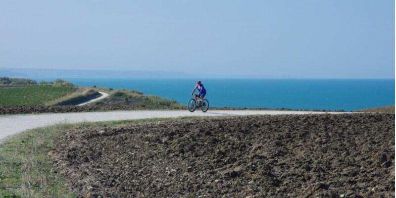
San Vito - Fossacesia
(Photo: © Enrico Spetrino/Shutterstock)
This stage of the Greenway is perhaps the most scenic of the entire route because it allows a privileged view of the so-called D'Annunzio Promontory and the homonymous hermitage.
But not only: here you will come across several trabocchi: the Punta Fornace one, the Turchino one (made famous because it was described by Gabriele D'Annunzio), as well as the Trabocchi Punta Tufano, Sasso della Cajana, Punta Torre, and Punta Cavalluccio.
Fossacesia - Torino di Sangro
Lake Dragoni and Cala le Morge where the homonymous trabocco stands on the typical white pebbles are the two main natural attractions you will encounter in this stretch of the Greenway. During the route, it is necessary to, for just two kilometers, exit the cycle path and travel a stretch of the state road.
Torino di Sangro - Punta Aderci
In this stage, the Greenway completely merges with the Punta Aderci Nature Reserve. By bike, you will travel through woods, meadows, and wide dirt areas until you reach the trabocco at Punta Aderci.
Here, the viewpoint is so high that it allows you to look back over the entire route so far faced and have an almost complete view of the entire Greenway.
Punta Aderci - Vasto Marina
The last stage of the cycling path also intersects with the natural reserve and overlooks the beach of San Nicola and the cove of Punta Penna.
Cycling along this last stretch of the Greenway, you can also admire the tower of Punta Penna and the Monument to the Bathing Woman, also known as the mermaid of Vasto.
Map and Chart
Below you will find the map with the stages of the Trabocchi Greenway itinerary.